About
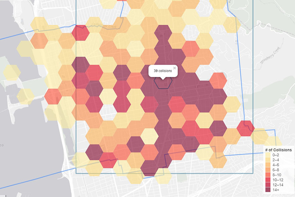
7 tools created to meet a wide variety of users needs, from creating a simple crash map of crashes happening in any cities in California to looking at pedestrian or bicyclists crashes in the vicinity of California schools.
Data Sources & Updates
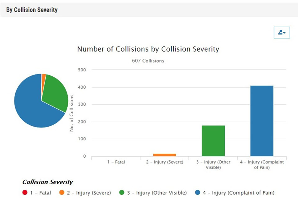
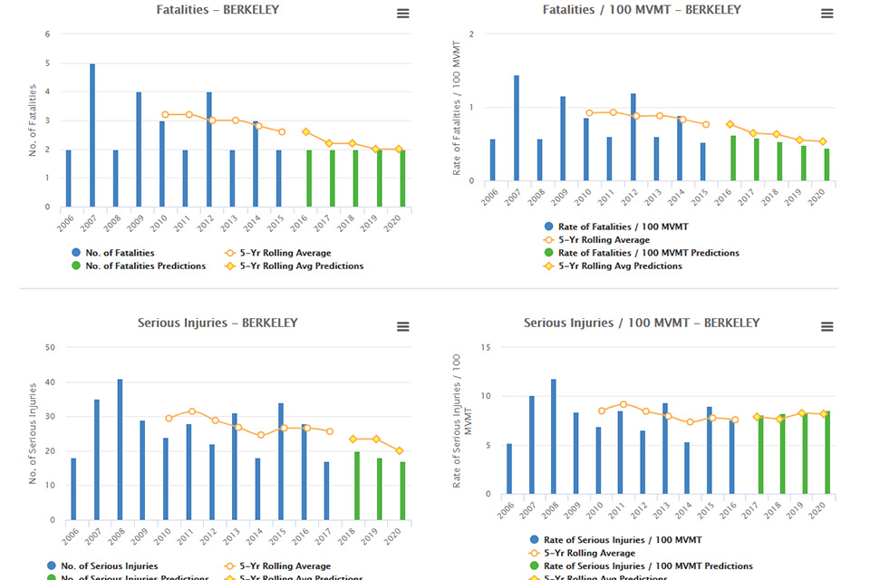
All 7 of these tools use the Statewide Integrated Traffic Records System ( SWITRS) as the primary data source. For more information, please see our Help section.
The Safety Performance Measure Target Setting tool uses FARS and HPMS data while the SWITRS GIS Map and the Safety heatmap utilize Census data in order to provide additional context.
Available Tools
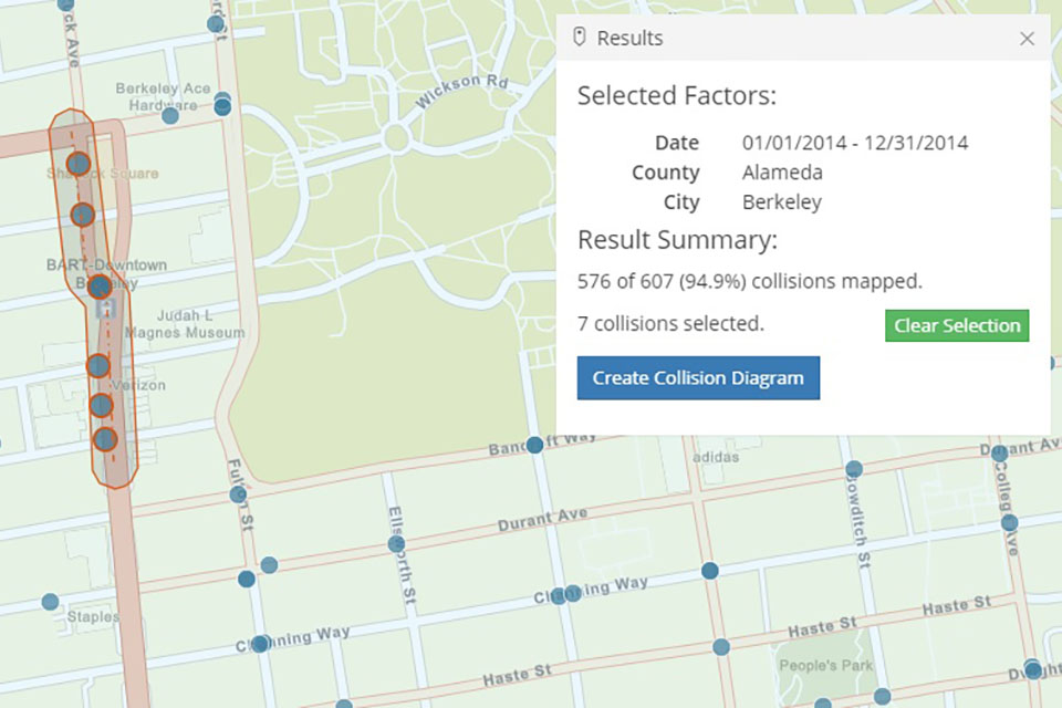
General SWITRS Queries & Map Tools
If you are a 1st time user or looking to create your own queries using SWITRS we recommend you try one of the tools below.

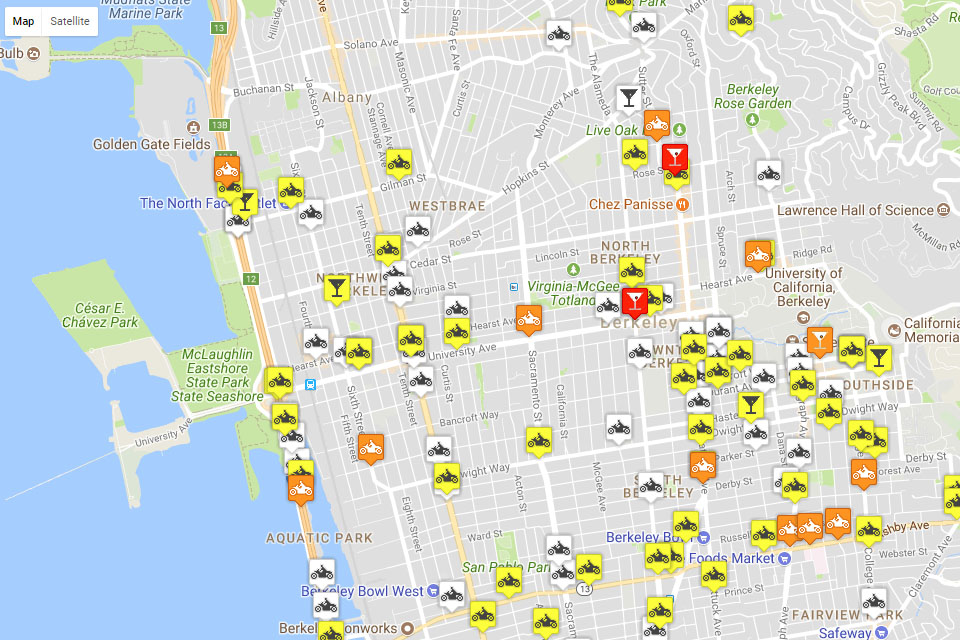
Program or Area Specific Tools
These tools support specific program initiatives and highlight different aspects of traffic safety throughout the state.
Need more help?
We have a page for that! Please visit our Help Page for tool tutorials, an explanation of the Statewide Integrated Traffic Records System (SWITRS) and how we geocode crashes along with it's codebook. If you have any questions not addressed on our help page, or have a specific data question please don't hesitate to contact the TIMS team at tims_info@berkeley.edu.